We offer drone mapping services for geodesy, civil engineering, agriculture and other industries. We have pilots with valid licenses, a registered drone and a permit to carry out aerial work in the Slovak Republic. If you are more interested in the UAV legislation, you can visit the site of the Slovak transport authority.
When mapping, we can combine drone data with classical geodetic measurements, ground photogrammetry and 3D laser scanning. A typical example is when the interior and exterior of a building are scanned with a 3D laser scanner, the texture is obtained from the ground photogrammetry and the missing roof and the hard-to-reach areas are scanned from the drone. The whole project is then connected to the state coordinate system by geodetic measurements using a global navigation satellite systems receiver or a total station.
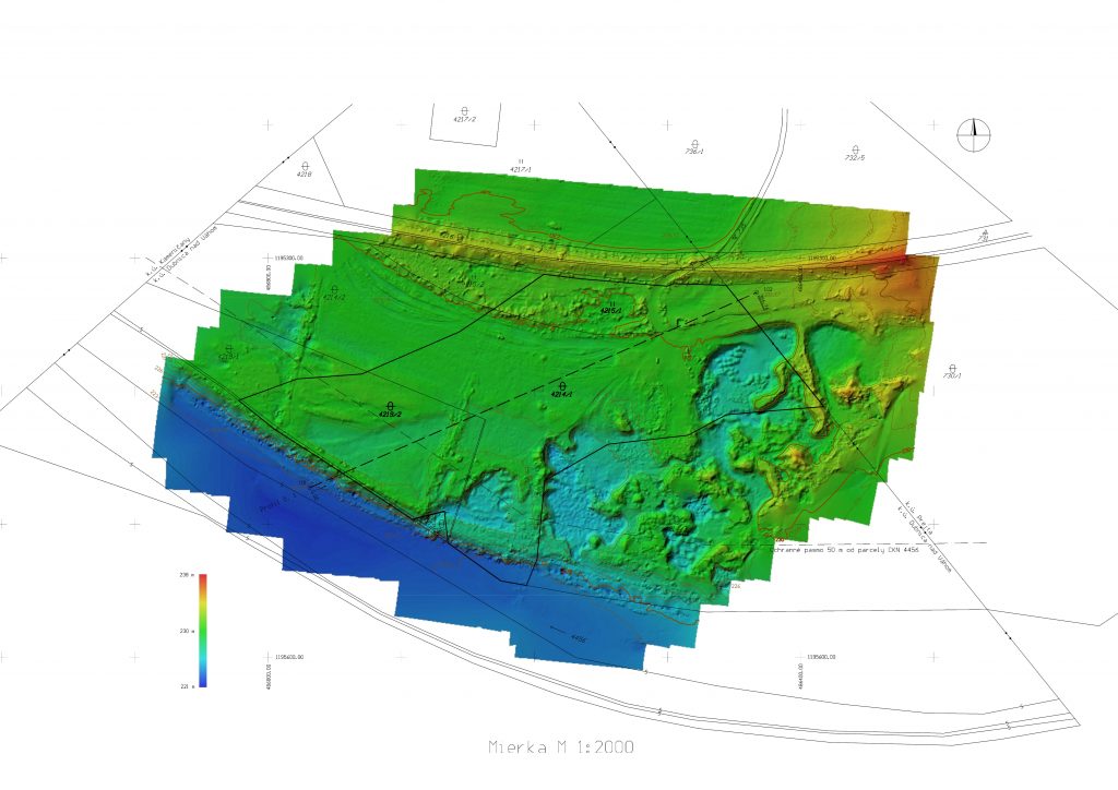
The results are accurate and georeferenced point clouds, 3D models, orthophoto maps or 3D animations of terrain, buildings, industrial facilities or other objects.
These outputs allow for various measurements and analyzes such as area calculations, volume calculations and the creation of other derived outputs such as contour lines, raster and vectorized outputs for CAD or GIS applications.
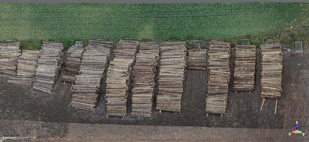
Drone mapping is a fast and efficient method of data collection, especially for large areas. Typical applications include, for example, stocktaking of wood storage.
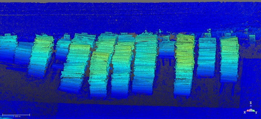
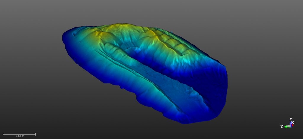
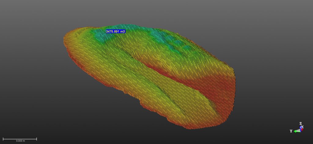
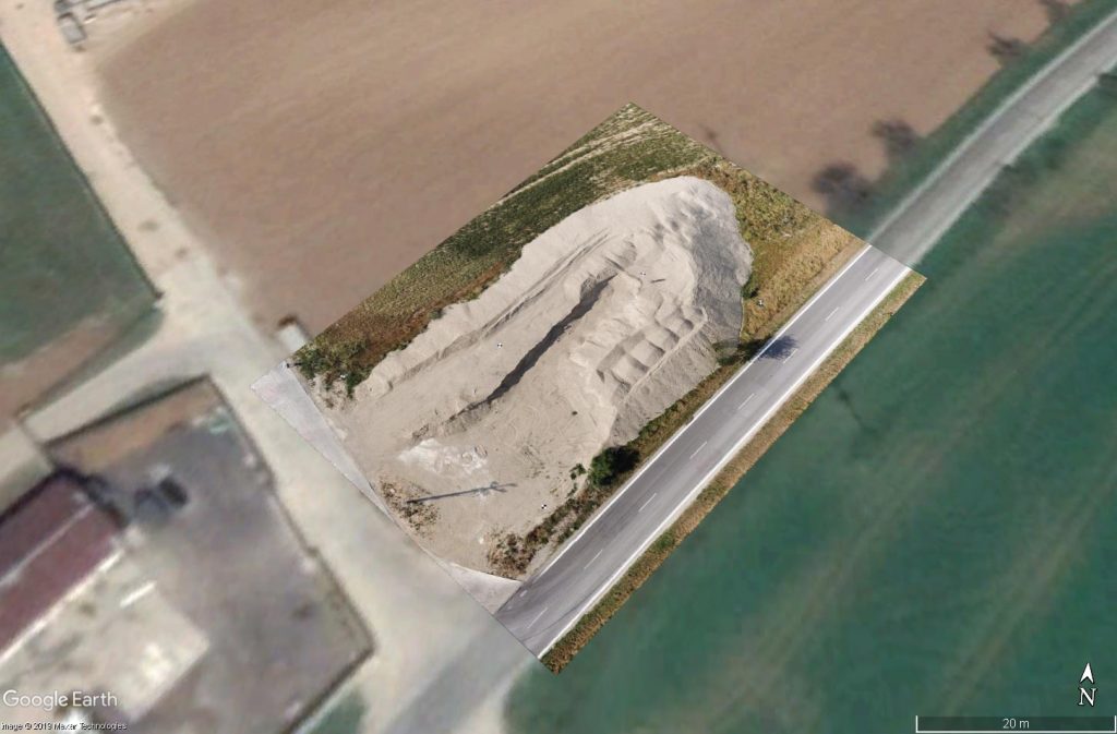
Another example is volume calculation of bulk materials.

Another application of drone mapping is to survey a vast area and to create a digital terrain model, contour lines. In this case, the drone saved us a lot of time that we would otherwise spend manually surveying with a total station or GNSS receiver.